
The Hydrocarbon Potential of the Aptian Salt Basin
Angola – Cameroon – Congo-Brazzaville – Congo (DRC) – Equatorial Guinea – Gabon – Namibia – São Tomé & Príncipe
This Fairway/Lynx Information Systems GIS Study of the hydrocarbon potential of the entire West African Aptian Salt Basin, including the coastal basins of Equatorial Guinea, Cameroon, Gabon, Congo, Angola and Namibia, contains a wealth of information on wells, production, seismic and potential field data, stretching from the Douala Basin in Cameroon through to the Kwanza Basin in Angola and further south into Namibia.
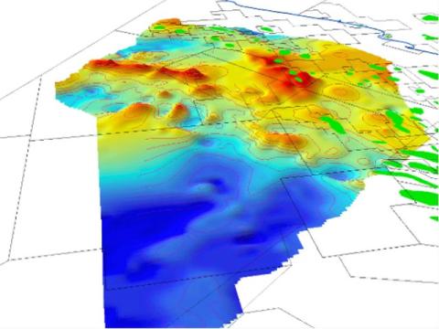
A series of regional structure maps and isopachs originally mapped at 1:250,000 using wells, seismic and potential field data provide a near-seamless picture of the major subsurface horizons
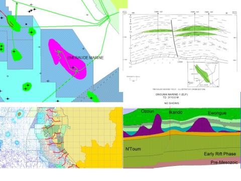
The Fields Database provides a systematic inventory of technical data for each producing field and major discovery, containing information on interests, structural style, reservoir parameters, reserve estimates, hydrocarbon type and production characteristics, with links to cross-sections, structure maps and well data
The Well Information Database provides information on each well in the basin, including Well Header information, Formation Tops and Reservoir/Source character.
Composite logs and seismic data provided for special areas of interest can be viewed using the Lynx Seismap extension for ESRI ArcGIS Desktop.
Tabular data for source rock geochemistry can be used to produce dynamic maps showing regional source rock quality and maturity trends.
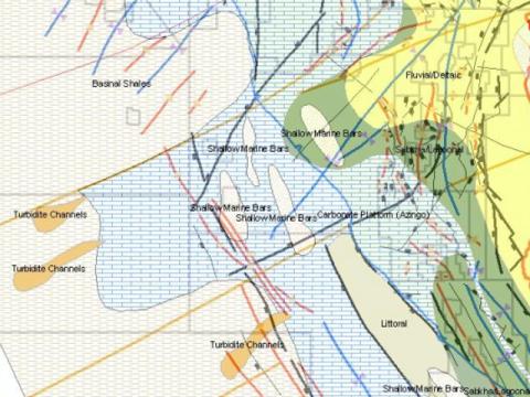
Paleogeographic maps illustrate the Gross Depositional Environment for the hydrocarbon source rock, seal and reservoir facies distribution for both the pre- and post-salt section.
Play Fairway Analysis – play maps have been created for all hydrocarbon systems in the area, utilising the reservoir and source rock databases.
Risk Analysis – Common Risk Segment maps have been generated from Gross Depositional Maps illustrating reservoir/source/seal effectiveness. Users can adjust risk factors and regenerate the risk maps.
The GIS project is accompanied by a comprehensive illustrated report (provided as a PDF document) which evaluates the hydrocarbon potential of the region.
A series of Lithostratigraphic Columns and regional Paleogeograhic Maps, produced by correlating wells in the report, illustrate the stratigraphic development of each area with special reference to sedimentary environments, facies distribution and the association of hydrocarbon-bearing source rocks, reservoirs and seals.
Regional layers within the GIS geodatabase provide an integrated geological/geophysical framework for exploration, covering the entire area of interest. Licenced blocks and concessions are updated on a regular basis, along with the Field Database and Well Information Database incorporated in the GIS Adviser.
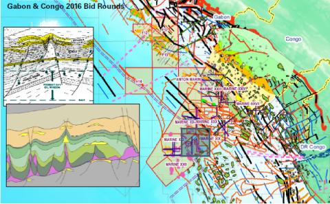
Recent updates to the Adviser have focused on the hydrocarbon potential and petroleum geology of Gabon and Congo-Brazzaville, in response to the recent launch of licensing rounds by the Gabonese and Congolese governments.
Please contact us for a detailed listing, or for more information.