
The Egyptian Ganoub El Wadi Petroleum Holding Company (GANOPE) have announced a new bid round, with 20 blocks on offer totalling over 125,000 sq km. Of the blocks 11 are located in the Western Desert, 2 in the Eastern Desert, 2 in the Red Sea and 5 in the Gulf of Suez.
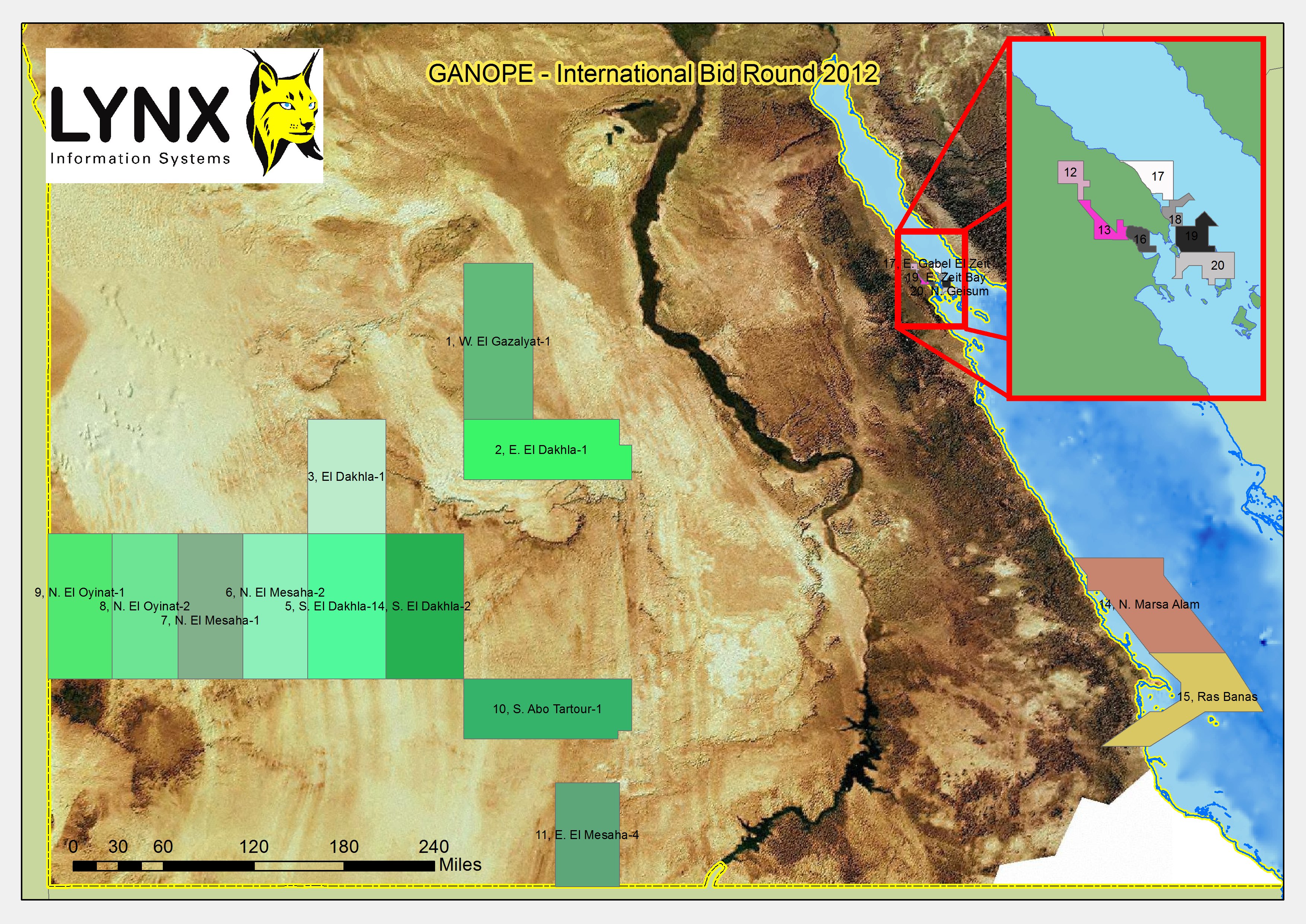
Ganope Bid Round Block location Map
The bid round is scheduled to close at noon on Thursday 30th May 2013. More official information from http://www.ganope.com
To download the block boundaries on offer as an ESRI shapefile, please enter your details before clicking on the link.
Ganope_BidRound2012_Blocks_Lynx.zip – shapefile containing open block boundaries for Egyptian GANOPE Bid Round 2012 (approx 5kb)
Note: these block boundaries are not definitive, and are intended only as a guide. The blocks have been digitised by Lynx, and may differ in places from those defined by the governing body.
Lynx Information Systems and its co-venturer Fairway Exploration sell a major, in-depth “GIS Exploration Adviser and Hydrocarbon Potential Report” for Egypt. This in-depth ArcGIS-enabled report and database (with supplementary onshore 2D seismic data) covers all the major producing and frontier basins, and has informed many IOCs in their new ventures exploration. Lynx have recently finished the 2012 Update for the Egypt GIS Exploration Adviser, for more information contact lynx@lynxinfo.co.uk, or view the Egypt page on our website