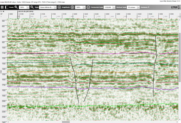
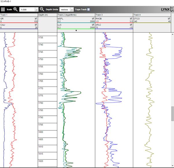
GIS web portals and virtual data rooms are contributing to increasing demands for thin-client visualisation of digital seismic data and wireline log data. Lynx now offers new HTML5-compatible viewers for modern web browsers which provide interactive display of 2D and 3D seismic data (iSeisview) and wireline logs (iLogview). These apps can be configured either as self-contained viewers, with integrated basemap display and list selection, or they can be linked with your existing web-mapping applications using the RESTful API.
Lynx iSeisview is a web-enabled seismic viewer app for displaying 2D and 3D seismic profiles in a standard web browser. You can explore an interactive demo of 2D seismic lines here: https://data.lynxinfo.co.uk/apps/iseisview/SWApproachesSeismic, and a demo of 3D seismic surveys here: https://data.lynxinfo.co.uk/apps/iseisview/ukogl3d.
iSeisview shows seismic profiles with interpreted horizons, faults and line intersections in an interactive web browser window, compatible with any modern web browser.
Lynx iLogview – is a brand new web-enabled viewer for wireline log data.
See a live preview of iLogview here: https://data.lynxinfo.co.uk/apps/ilogview/egypt?request=getLogview&logId=2
iLogview shows wireline logs in a familiar interactive composite log display. Formation tops and core photos can be added in separate tracks.
iLogview V1.0 is due for release in autumn 2015. Please get in touch if you would like an early evaluation.
The server requirements for iSeisview and iLogview are:
- Microsoft Windows Server
- Apache Tomcat 8 (or newer)
- Java JRE 8
- Oracle Spatial 11g R2 (optional)
iSeisview – seismic data prerequisites:
- 2D seismic data – SEG-Y (or SEG-Y Revision 1) format
- 3D seismic data – SEG-Y Revision 1 format
- Seismic metadata (line/survey name, shotpoint/inline/crossline range, SEG-Y filepath) in an Oracle database table, CSV file or shapefile
- Optional seismic line locations or survey polygon outlines in KML, Oracle Spatial or shapefile format for built-in map display and line-intersection display
iLogview – wireline log data prerequisites:
- LAS format
- Log metadata (well name, start/stop depths, curve list) and curve dictionary (display scale and track number for each curve) in Oracle database tables or CSV files
- Optional well locations in KML, Oracle Spatial or shapefile format for built-in map display
iSeisview and iLogview may be licensed for internal use within your organisation, or for external use on public-facing websites. We can also provide short-term hosting solutions for virtual data rooms and farm-outs.
If you have any questions about the technical implementation of iSeisview and iLogview, queries about the licensing and deployment options, or if you would like to arrange an evaluation, please contact us.


