iSeisview is a new web-enabled seismic viewer app developed by Lynx. The application works with industry-standard SEG-Y and enables interactive viewing of 2D and 3D seismic trace data via a standard web browser. iSeisview provides a secure and fast way of streaming seismic, and has been developed to facilitate improved end-user access to real-time trace data for the following scenarios:
- Corporate intranets and shared portals
- Web maps and enterprise GIS applications
- Virtual Data Rooms for Farm-outs and Licensing Rounds
- Presenting newly acquired seismic spec data
iSeisview builds on Lynx’s comprehensive experience of working with seismic data, and provides new ways of integrating your company seismic data with your web mapping applications.
The Lynx Web Seismic Viewer supports all common desktop browsers (Google Chrome, Mozilla Firefox, Apple Safari and Microsoft Internet Explorer 11, and Microsoft Internet Explorer 8 for Windows XP), plus the Safari and Google Chrome browsers on Apple iPad.
-
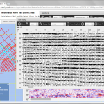
-
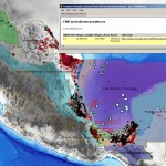
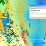
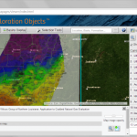
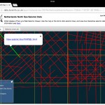
iSeisview desktop browser screenshots – basemap with multiple seismic viewers
-
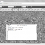
-
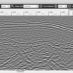
iSeisview desktop browser screenshots – greyscale seismic display with C-Card headers
-
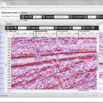
-
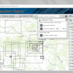
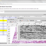
iSeisview desktop browser screenshots – list of seismic lines for display
See the Lynx Web Seismic Viewer in action in these two demo websites:
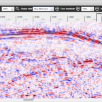
Users can interactively zoom and pan seismic lines, choose from a range of familiar display styles and scales, and change the trace display amplitude using touch-friendly buttons in the seismic viewer toolbar.
-
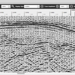
-
iSeisview display styles – Variable Area/Wiggle
-
-
iSeisview display styles – Greyscale
-
-
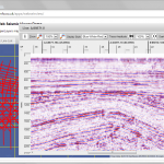
iSeisview display styles – Blue-White-Red
iSeisview requires no end-user configuration and no browser plugins. The browser client uses native HTML5 and Javascript/AJAX for seamless display of seismic data. A user just clicks on a link to launch the seismic viewer.
-
-
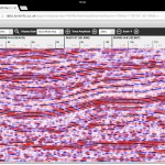
iSeisview iPad screenshots – use familiar gestures to navigate the seismic data – tap-hold to select, swipe to scroll and pinch to zoom
-
-
iSeisview iPad screenshots – use familiar gestures to navigate the seismic data – tap-hold to select, swipe to scroll and pinch to zoom
Seismic Data Security
Distributed users need access to centrally stored seismic data. Transmitting seismic data via slow or unreliable network connections for ‘thick-client’ display is not always desirable or practical. By utilising iSeisview, your SEG-Y data is securely stored as standard SEG-Y files on your firewalled web server. The digital seismic trace data are never exposed directly to the browser client: the browser receives auto-generated cacheable image tiles which are reassembled in the browser to display the requested seismic line. Server-side configuration allows the administrator to restrict the permitted display scales and zoom levels if required.
iSeisview Server Configuration
System Requirements [updated Sept 2023]:
- Microsoft Windows Server
- Apache Tomcat 8 (or newer)
- Java JRE 8 (Java or OpenJDK)
- Optional database – Oracle Spatial 11g R2, Microsoft SQL Server 2012 (or newer), PostgreSQL 9 (or newer)
iSeisview Components:
- Server – Windows console-mode (32bit) executable generates image tiles from SEG-Y files
- Server – Java servlet – manage incoming requests for seismic line metadata and image tiles, manage server-side image tile cache
- HTML5 – client browser – Javascript/CSS seismic viewer – requests seismic line shot/trace/time metadata and image tiles, re-assemble the image tiles for display
Data Prerequisites:
- Seismic 2D data files in SEG-Y format
- Seismic metadata (line-name, shotpoint range, time range, SEGY file path etc) in a database table or CSV file
- Optional seismic locations in KML or database spatial format for line intersection display
The ‘out of the box’ configuration provides basemaps from Bing or OpenStreetMap, and a searchable and sortable list of your seismic lines. Alternatively, use a custom configuration to add direct links to seismic lines from an existing web map by using links like this:
http://data.lynxinfo.co.uk/apps/iseisview/SWApproachesSeismic?request=getSeisview&lineId=20690
Each line has a unique Line ID number, as listed in your seismic metadata table. You can use this Line ID to generate URLs dynamically for your existing web map.
You can add many different seismic datasets to iSeisview; each distinct dataset can be published as a separate service. Each service has independent request and server-side tile cache management.
Licensing and Deployment Options
- iSeisview Deployment License – take advantage of full integration with your existing web mapping applications. Deploy to your own server or a cloud-based server. Use the Javascript API to create a customised seismic viewer, or modify the CSS style of the existing viewer.
- iSeisview Hosting – for short-term websites (eg farm-outs and other virtual data rooms), Lynx will host your seismic data, and provide a secure website for display of your seismic data using iSeisview. We will work with you to provide the level of customisation you require for your website – from a corporate logo and additional map layers with linked information to user authentication and activity logging.
Contact us for more information about these licensing options, or for a more in-depth discussion about either the technical implementation of the Lynx Web Seismic Viewer, or the ways in which you can use it to improve access to your seismic data within your organisation.
